 vesseltracker.com
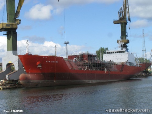
Vessel Syn Antares IMO: 9512848, MMSI: 247369100 Lpg Tanker
UTC, 51.07667, 1.86833, course: -1, speed: 0
UTC, 51.07807, 1.87139, course: 211, speed: 0.1
2026-01-29 21:37:21 UTC, 51.07853, 1.87090, course: 204, speed: 0.1
Live AIS position:
UTC. Near Calais),
updated 2026-01-29 21:37:21 UTC.
Find the position of the vessel Syn Antares on the map. The latter are known coordinates and path.
marine traffic ship tracker show on live map
The current position of vessel Syn Antares is 51.07853 lat / 1.87090 lng. Updated: 2026-01-29 21:37:21 UTCCurrently sailing under the flag of Italy
Syn Antares built in 2014 year
Deadweight:
8000 tDetails:
Last coordinates of the vessel:
UTC, 51.07698, 1.86741, course: 97, speed: 0.1UTC, 51.07667, 1.86833, course: -1, speed: 0
UTC, 51.07807, 1.87139, course: 211, speed: 0.1
2026-01-29 21:37:21 UTC, 51.07853, 1.87090, course: 204, speed: 0.1