 vesseltracker.com
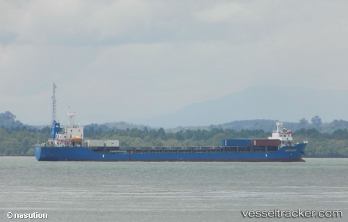
Vessel T A N T O S E H A T IMO: 9714197, MMSI: 525013034 General Cargo Ship
UTC, 1.60902, 101.93169, course: -1, speed: 8.5
UTC, 1.35500, 102.16333, course: -1, speed: 0
2026-02-26 13:49:13 UTC, 1.35500, 102.16333, course: -1, speed: 0
Live AIS position:
UTC. 35 nm NW of FUTONG),
updated 2026-02-26 13:49:13 UTC.
Find the position of the vessel T A N T O S E H A T on the map. The latter are known coordinates and path.
marine traffic ship tracker show on live map
The current position of vessel T A N T O S E H A T is 1.35500 lat / 102.16333 lng. Updated: 2026-02-26 13:49:13 UTCDetails:
Last coordinates of the vessel:
UTC, 1.77718, 101.88841, course: -1, speed: 8.8UTC, 1.60902, 101.93169, course: -1, speed: 8.5
UTC, 1.35500, 102.16333, course: -1, speed: 0
2026-02-26 13:49:13 UTC, 1.35500, 102.16333, course: -1, speed: 0