 vesseltracker.com
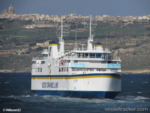
Vessel Ta Pinu IMO: 9176307, MMSI: 248692000 Passenger Ro Ro Cargo Ship
UTC, 36.02532, 14.30094, course: -1, speed: 6.9
UTC, 35.99959, 14.32123, course: -1, speed: 10.8
2026-03-01 17:33:41 UTC, 36.02477, 14.30027, course: -1, speed: 6.5
Live AIS position:
UTC. Near MGARR),
updated 2026-03-01 17:33:41 UTC.
Find the position of the vessel Ta Pinu on the map. The latter are known coordinates and path.
marine traffic ship tracker show on live map
The current position of vessel Ta Pinu is 36.02477 lat / 14.30027 lng. Updated: 2026-03-01 17:33:41 UTCCurrently sailing under the flag of Malta
Ta Pinu built in 2000 year
Deadweight:
1064 tDetails:
Last coordinates of the vessel:
UTC, 36.02532, 14.30094, course: -1, speed: 6.9UTC, 36.02532, 14.30094, course: -1, speed: 6.9
UTC, 35.99959, 14.32123, course: -1, speed: 10.8
2026-03-01 17:33:41 UTC, 36.02477, 14.30027, course: -1, speed: 6.5