 vesseltracker.com
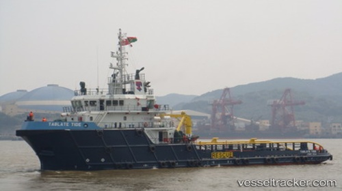
Vessel Tablate Tide IMO: 9615810, MMSI: 576984000 Offshore Tug Supply Ship
UTC, 28.13647, 49.47292, course: 201, speed: 5.6
UTC, 27.94918, 49.38103, course: 199, speed: 4.6
2026-02-28 03:35:34 UTC, 27.81014, 49.26691, course: 217, speed: 7.6
Live AIS position:
UTC. 17 nm N of Ras Al Khair),
updated 2026-02-28 03:35:34 UTC.
Find the position of the vessel Tablate Tide on the map. The latter are known coordinates and path.
marine traffic ship tracker show on live map
The current position of vessel Tablate Tide is 27.81014 lat / 49.26691 lng. Updated: 2026-02-28 03:35:34 UTCDetails:
Last coordinates of the vessel:
UTC, 28.31411, 49.51747, course: 233, speed: 1.4UTC, 28.13647, 49.47292, course: 201, speed: 5.6
UTC, 27.94918, 49.38103, course: 199, speed: 4.6
2026-02-28 03:35:34 UTC, 27.81014, 49.26691, course: 217, speed: 7.6