 vesseltracker.com
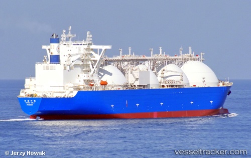
Vessel Taitar No.4 IMO: 9403657, MMSI: 351767000 Lng Tanker
UTC, 3.19549, 100.49862, course: 145, speed: 15.1
UTC, 2.98028, 100.80777, course: 129, speed: 14.7
2026-02-01 09:48:57 UTC, 2.70241, 101.13926, course: 120, speed: 16
Live AIS position:
UTC. 17 nm SW of Pulau Indah),
updated 2026-02-01 09:48:57 UTC.
Find the position of the vessel Taitar No.4 on the map. The latter are known coordinates and path.
marine traffic ship tracker show on live map
The current position of vessel Taitar No.4 is 2.70241 lat / 101.13926 lng. Updated: 2026-02-01 09:48:57 UTCCurrently sailing under the flag of Panama
Taitar No.4 built in 2010 year
Deadweight:
77053 tDetails:
Last coordinates of the vessel:
UTC, 3.62833, 100.08500, course: -1, speed: 14UTC, 3.19549, 100.49862, course: 145, speed: 15.1
UTC, 2.98028, 100.80777, course: 129, speed: 14.7
2026-02-01 09:48:57 UTC, 2.70241, 101.13926, course: 120, speed: 16