 vesseltracker.com
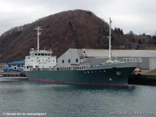
Vessel Taiyo Maru No.18 IMO: 9567817, MMSI: 431001326 General Cargo Ship
UTC, 40.52869, 141.54321, course: 354, speed: 0
UTC, 40.52869, 141.54321, course: 353, speed: 0
2026-02-01 13:50:26 UTC, 40.52869, 141.54320, course: 354, speed: 0
Live AIS position:
UTC. Near Hachinohe),
updated 2026-02-01 13:50:26 UTC.
Find the position of the vessel Taiyo Maru No.18 on the map. The latter are known coordinates and path.
marine traffic ship tracker show on live map
The current position of vessel Taiyo Maru No.18 is 40.52869 lat / 141.54320 lng. Updated: 2026-02-01 13:50:26 UTCDetails:
Last coordinates of the vessel:
UTC, 40.52870, 141.54321, course: 354, speed: 0UTC, 40.52869, 141.54321, course: 354, speed: 0
UTC, 40.52869, 141.54321, course: 353, speed: 0
2026-02-01 13:50:26 UTC, 40.52869, 141.54320, course: 354, speed: 0