 vesseltracker.com
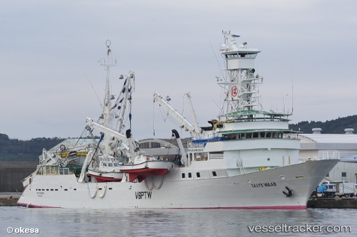
Vessel Taiyo Waab IMO: 9234173, MMSI: 510060000 Fishing Vessel
UTC, 10.92167, 143.69667, course: -1, speed: 14
UTC, 10.92167, 143.69667, course: -1, speed: 14
2026-01-30 05:37:09 UTC, 10.92167, 143.69667, course: -1, speed: 14
Live AIS position:
UTC. 142 nm NW of Gaferut Atoll),
updated 2026-01-30 05:37:09 UTC.
Find the position of the vessel Taiyo Waab on the map. The latter are known coordinates and path.
marine traffic ship tracker show on live map
The current position of vessel Taiyo Waab is 10.92167 lat / 143.69667 lng. Updated: 2026-01-30 05:37:09 UTCDetails:
Last coordinates of the vessel:
UTC, 10.92167, 143.69667, course: -1, speed: 14UTC, 10.92167, 143.69667, course: -1, speed: 14
UTC, 10.92167, 143.69667, course: -1, speed: 14
2026-01-30 05:37:09 UTC, 10.92167, 143.69667, course: -1, speed: 14