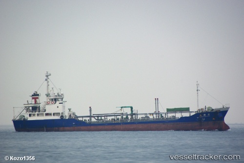
vessel Takatsuru IMO: 9084841, Oil Products Tanker
vesseltracker.com
Vessel Takatsuru IMO: 9084841, Oil Products Tanker
MMSI: 667001992 callsign: 9LU2795 size: 10x64

Find the position of the vessel Takatsuru on the map. The latter are known coordinates and path.

marine traffic ship tracker show on live map

The current position of vessel Takatsuru is 25.4664 lat / 55.5017 lng. Updated: 2024-04-26 21:46:17 UTC
Details:


Last coordinates of the vessel:
UTC, 25.4664, 55.5017, course: -1, speed: 0.1
UTC, 25.4664, 55.5017, course: -1, speed: 0.2
2024-04-26 21:46:17 UTC, 25.4664, 55.5017, course: -1, speed: 0.1

Track of the vessel in the last 14 days


Most frequent ports a vessels calls at Takatsuru (667001992):

Hamriyah, traffic: 2
Sharjah, traffic: 2
Tarabulus, traffic: 1

Link to the map:


Find another ship

Takatsuru (667001992) last ports (portcalls and passsages)

Hamriyah | 2024-04-25 07:06:37
Hamriyah | 2024-04-21 06:34:22
Sharjah | 2024-03-27 18:02:50
Sharjah | 2024-03-22 18:20:27
Tarabulus | 2021-09-30 15:47:35