 vesseltracker.com
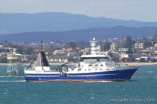
Vessel Tangaroa IMO: 9011571, MMSI: 512000058 Fishing Support Vessel
UTC, -44.05667, 176.03168, course: -1, speed: 4
UTC, -44.14300, 176.19043, course: 156, speed: 5.3
2026-01-29 21:55:12 UTC, -44.25520, 176.22607, course: 13, speed: 3.4
Live AIS position:
UTC. 144 nm E of Akaroa),
updated 2026-01-29 21:55:12 UTC.
Find the position of the vessel Tangaroa on the map. The latter are known coordinates and path.
marine traffic ship tracker show on live map
The current position of vessel Tangaroa is -44.25520 lat / 176.22607 lng. Updated: 2026-01-29 21:55:12 UTCCurrently sailing under the flag of New Zealand
Tangaroa built in 1991 year
Details:
Last coordinates of the vessel:
UTC, -44.04553, 175.95375, course: 95, speed: 3.4UTC, -44.05667, 176.03168, course: -1, speed: 4
UTC, -44.14300, 176.19043, course: 156, speed: 5.3
2026-01-29 21:55:12 UTC, -44.25520, 176.22607, course: 13, speed: 3.4