 vesseltracker.com
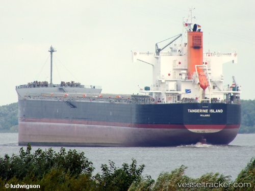
Vessel Tangerine Island IMO: 9512355, MMSI: 538004478 Bulk Carrier
UTC, -34.13500, 0.80667, course: -1, speed: 11
UTC, -34.13822, 0.30233, course: 270, speed: 11.5
2026-01-30 12:31:03 UTC, -34.13115, -0.20624, course: 269, speed: 11.5
Live AIS position:
UTC. Open sea (no nearby ports in database)),
updated 2026-01-30 12:31:03 UTC.
Find the position of the vessel Tangerine Island on the map. The latter are known coordinates and path.
marine traffic ship tracker show on live map
The current position of vessel Tangerine Island is -34.13115 lat / -0.20624 lng. Updated: 2026-01-30 12:31:03 UTCDetails:
Last coordinates of the vessel:
UTC, -34.13920, 1.29271, course: 271, speed: 11.5UTC, -34.13500, 0.80667, course: -1, speed: 11
UTC, -34.13822, 0.30233, course: 270, speed: 11.5
2026-01-30 12:31:03 UTC, -34.13115, -0.20624, course: 269, speed: 11.5