 vesseltracker.com
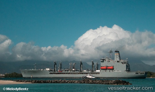
Vessel Tanker 187 IMO: 8302416, MMSI: 303849000 Naval Naval Auxiliary
Live Vessel Tanker 187 Analytics (details, animations, etc.)
Live AIS position: UTC. Near HANJIN INDUSTRIES), updated 2026-01-06 00:12:03 UTC.Find the position of the vessel Tanker 187 on the map. The latter are known coordinates and path.
marine traffic ship tracker show on live map
The current position of vessel Tanker 187 is 14.78342 lat / 120.21474 lng. Updated: 2026-01-06 00:12:03 UTCCurrently sailing under the flag of USA
Tanker 187 built in 1986 year
Deadweight:
30412 tDetails:
Last coordinates of the vessel:
2026-01-06 00:12:03 UTC, 14.78342, 120.21474, course: 206, speed: 9