 vesseltracker.com
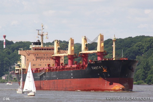
Vessel Tanta T IMO: 9497086, MMSI: 538004100 Bulk Carrier
UTC, 22.21152, -97.86074, course: 109, speed: 0
UTC, 22.21155, -97.86073, course: 109, speed: 0
2026-01-31 13:54:36 UTC, 22.21154, -97.86070, course: 109, speed: 0
Live AIS position:
UTC. Near Benito Juarez),
updated 2026-01-31 13:54:36 UTC.
Find the position of the vessel Tanta T on the map. The latter are known coordinates and path.
marine traffic ship tracker show on live map
The current position of vessel Tanta T is 22.21154 lat / -97.86070 lng. Updated: 2026-01-31 13:54:36 UTCCurrently sailing under the flag of Marshall Is
Tanta T built in 2011 year
Deadweight:
32500 tDetails:
Last coordinates of the vessel:
UTC, 22.21153, -97.86069, course: 109, speed: 0UTC, 22.21152, -97.86074, course: 109, speed: 0
UTC, 22.21155, -97.86073, course: 109, speed: 0
2026-01-31 13:54:36 UTC, 22.21154, -97.86070, course: 109, speed: 0