 vesseltracker.com
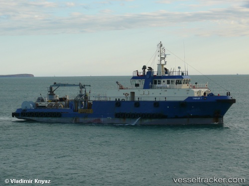
Vessel Tanux I IMO: 9374600, MMSI: 538002949 Offshore Support Vessel
UTC, 42.46137, 32.90203, course: 105, speed: 5
UTC, 42.46137, 32.90203, course: 105, speed: 5
2026-02-01 02:47:19 UTC, 42.46137, 32.90203, course: 105, speed: 5
Live AIS position:
UTC. 34 nm N of Cide),
updated 2026-02-01 02:47:19 UTC.
Find the position of the vessel Tanux I on the map. The latter are known coordinates and path.
marine traffic ship tracker show on live map
The current position of vessel Tanux I is 42.46137 lat / 32.90203 lng. Updated: 2026-02-01 02:47:19 UTCCurrently sailing under the flag of Marshall Is
Tanux I built in 2006 year
Deadweight:
949 tDetails:
Last coordinates of the vessel:
UTC, 42.42879, 32.82350, course: 96, speed: 6.6UTC, 42.46137, 32.90203, course: 105, speed: 5
UTC, 42.46137, 32.90203, course: 105, speed: 5
2026-02-01 02:47:19 UTC, 42.46137, 32.90203, course: 105, speed: 5