 vesseltracker.com
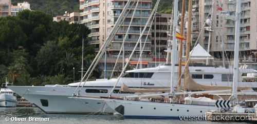
Vessel Te Manu IMO: 1006269, MMSI: 319315000 Service Ship
UTC, 26.06189, -80.13352, course: 179, speed: 0
UTC, 26.06187, -80.13356, course: 179, speed: 0
2026-02-04 18:27:29 UTC, 26.06190, -80.13357, course: 179, speed: 0
Live AIS position:
UTC. Near Dania Beach),
updated 2026-02-04 18:27:29 UTC.
Find the position of the vessel Te Manu on the map. The latter are known coordinates and path.
marine traffic ship tracker show on live map
The current position of vessel Te Manu is 26.06190 lat / -80.13357 lng. Updated: 2026-02-04 18:27:29 UTCCurrently sailing under the flag of Cayman Is
Te Manu built in 1998 year
Deadweight:
110 tDetails:
Last coordinates of the vessel:
UTC, 26.06190, -80.13359, course: 179, speed: 0UTC, 26.06189, -80.13352, course: 179, speed: 0
UTC, 26.06187, -80.13356, course: 179, speed: 0
2026-02-04 18:27:29 UTC, 26.06190, -80.13357, course: 179, speed: 0