 vesseltracker.com
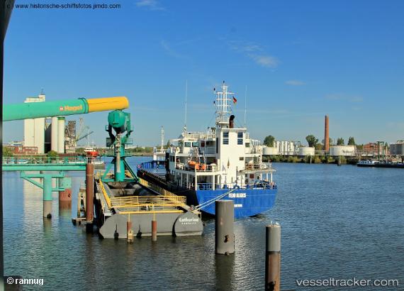
Vessel Tejo Alges IMO: 9240251, MMSI: 255805994 Multi Purpose Carrier
Live AIS position:
UTC. 167 nm W of Howland Island),
updated 2026-01-03 16:13:43 UTC.
Find the position of the vessel Tejo Alges on the map. The latter are known coordinates and path.
marine traffic ship tracker show on live map
The current position of vessel Tejo Alges is 1.18046 lat / -179.39316 lng. Updated: 2026-01-03 16:13:43 UTCCurrently sailing under the flag of Portugal
Tejo Alges built in 2001 year
Deadweight:
4247 tDetails:
Last coordinates of the vessel:
2026-01-03 16:13:43 UTC, 1.18046, -179.39316, course: 170, speed: 79.9