 vesseltracker.com
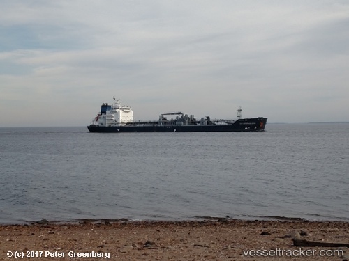
Vessel The Sheriff IMO: 9492311, MMSI: 538004792 Bitumen Tanker
UTC, 34.39156, -47.56854, course: 72, speed: 10.1
UTC, 34.44207, -47.31012, course: 73, speed: 10.6
2026-01-30 20:27:07 UTC, 34.56374, -46.68829, course: 74, speed: 10.3
Live AIS position:
UTC. 220 nm SE of Benahavis),
updated 2026-01-30 20:27:07 UTC.
Find the position of the vessel The Sheriff on the map. The latter are known coordinates and path.
marine traffic ship tracker show on live map
The current position of vessel The Sheriff is 34.56374 lat / -46.68829 lng. Updated: 2026-01-30 20:27:07 UTCCurrently sailing under the flag of Marshall Is
The Sheriff built in 2013 year
Deadweight:
14911 tDetails:
Last coordinates of the vessel:
UTC, 34.29773, -48.04702, course: 67, speed: 10.5UTC, 34.39156, -47.56854, course: 72, speed: 10.1
UTC, 34.44207, -47.31012, course: 73, speed: 10.6
2026-01-30 20:27:07 UTC, 34.56374, -46.68829, course: 74, speed: 10.3