 vesseltracker.com
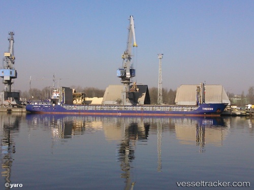
Vessel Theseus IMO: 9199256, MMSI: 304011027 Multi Purpose Carrier
UTC, 53.12556, 4.30729, course: 221, speed: 7.9
UTC, 53.03667, 4.15833, course: -1, speed: 8
2026-01-31 07:18:56 UTC, 52.78742, 3.94764, course: 187, speed: 10.2
Live AIS position:
UTC. 25 nm W of Schoorl),
updated 2026-01-31 07:18:56 UTC.
Find the position of the vessel Theseus on the map. The latter are known coordinates and path.
marine traffic ship tracker show on live map
The current position of vessel Theseus is 52.78742 lat / 3.94764 lng. Updated: 2026-01-31 07:18:56 UTCCurrently sailing under the flag of Antigua Barbuda
Theseus built in 2000 year
Deadweight:
2500 tDetails:
Last coordinates of the vessel:
UTC, 53.42167, 4.54500, course: -1, speed: 6UTC, 53.12556, 4.30729, course: 221, speed: 7.9
UTC, 53.03667, 4.15833, course: -1, speed: 8
2026-01-31 07:18:56 UTC, 52.78742, 3.94764, course: 187, speed: 10.2