 vesseltracker.com
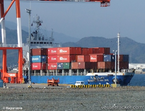
Vessel Tian Fu Tianjin IMO: 9142265, MMSI: 413301510 Container Ship
UTC, 34.05910, 126.24235, course: 94, speed: 10.4
UTC, 34.03204, 126.66559, course: 97, speed: 10.6
2026-01-25 20:06:51 UTC, 33.99371, 127.09496, course: 101, speed: 11.5
Live AIS position:
UTC. 10 nm W of Geomundo),
updated 2026-01-25 20:06:51 UTC.
Find the position of the vessel Tian Fu Tianjin on the map. The latter are known coordinates and path.
marine traffic ship tracker show on live map
The current position of vessel Tian Fu Tianjin is 33.99371 lat / 127.09496 lng. Updated: 2026-01-25 20:06:51 UTCCurrently sailing under the flag of China
Details:
Last coordinates of the vessel:
UTC, 34.06654, 125.91205, course: 85, speed: 11.2UTC, 34.05910, 126.24235, course: 94, speed: 10.4
UTC, 34.03204, 126.66559, course: 97, speed: 10.6
2026-01-25 20:06:51 UTC, 33.99371, 127.09496, course: 101, speed: 11.5