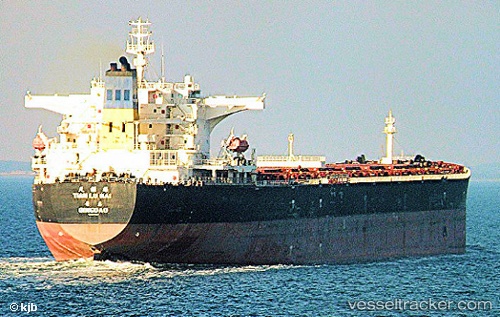
vessel Tian Lu Hai IMO: 9298480, Bulk Carrier
vesseltracker.com
Vessel Tian Lu Hai IMO: 9298480, Bulk Carrier
MMSI: 413099000 callsign: BOIG size: 289x45

Find the position of the vessel Tian Lu Hai on the map. The latter are known coordinates and path.

marine traffic ship tracker show on live map

The current position of vessel Tian Lu Hai is 30.01015 lat / 121.74023 lng. Updated: 2025-09-05 07:20:41 UTC

Currently sailing under the flag of China

Tian Lu Hai built in 2005 year

Deadweight:
174398 t

Details:


Last coordinates of the vessel:
2025-09-05 07:20:41 UTC, 30.01015, 121.74023, course: 90, speed: 0

Track of the vessel in the last 14 days


Most frequent ports a vessels calls at Tian Lu Hai (413099000):

Sambu, traffic: 7
Dalian, traffic: 7
Dalien, traffic: 7
Singapore, traffic: 5
Qingdao, traffic: 3
San Nicolas, traffic: 3
Selat Sunda, traffic: 3
Sekondi, traffic: 2
Takoradi, traffic: 2
Bohang, traffic: 2
Pohang, traffic: 2

Link to the map:


Find another ship

Tian_Lu_Hai (413099000) last ports (portcalls and passsages)

Qingdao | 2023-12-12 00:08:45
Qingdao | 2023-12-07 23:22:38
Qingdao | 2023-12-03 23:17:46
Takoradi | 2023-10-16 04:26:13
Takoradi | 2023-10-12 03:53:26
Singapore | 2023-08-15 06:58:19
Singapore | 2023-08-05 23:17:22
Singapore | 2023-07-13 05:51:49
Selat Sunda | 2023-06-18 04:47:15
San Nicolas | 2023-02-02 17:42:09
San Nicolas | 2023-01-29 17:34:33
San Nicolas | 2023-01-25 17:06:12
Pohang | 2022-07-21 01:56:53
Pohang | 2022-07-17 01:53:22
Dalien | 2022-05-22 16:50:57
Dalien | 2022-05-18 16:36:43
Dalien | 2022-05-14 16:28:39
Dalien | 2022-05-10 13:23:56
Dalien | 2022-05-06 13:12:15
Dalien | 2022-05-02 12:14:26
Dalien | 2022-04-13 00:06:53
Selat Sunda | 2022-03-19 18:57:25
Singapore | 2021-12-31 16:35:43
Sambu | 2021-12-31 16:05:12