 vesseltracker.com
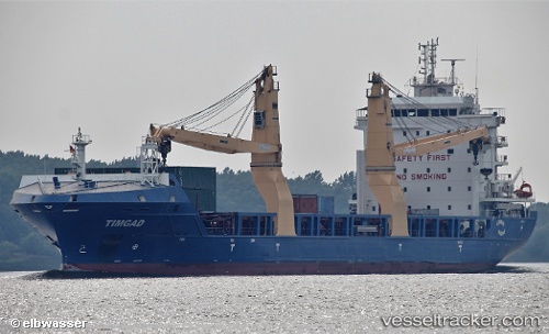
Vessel Timgad IMO: 9697337, MMSI: 605086080 Multi Purpose Carrier
UTC, 36.80667, 3.09500, course: -1, speed: 0
UTC, 36.80667, 3.09500, course: -1, speed: 0
2026-01-25 16:19:50 UTC, 36.80667, 3.09500, course: -1, speed: 0
Live AIS position:
UTC. Near Algiers),
updated 2026-01-25 16:19:50 UTC.
Find the position of the vessel Timgad on the map. The latter are known coordinates and path.
marine traffic ship tracker show on live map
The current position of vessel Timgad is 36.80667 lat / 3.09500 lng. Updated: 2026-01-25 16:19:50 UTCDetails:
Last coordinates of the vessel:
UTC, 36.80584, 3.09435, course: 299, speed: 0.2UTC, 36.80667, 3.09500, course: -1, speed: 0
UTC, 36.80667, 3.09500, course: -1, speed: 0
2026-01-25 16:19:50 UTC, 36.80667, 3.09500, course: -1, speed: 0