 vesseltracker.com
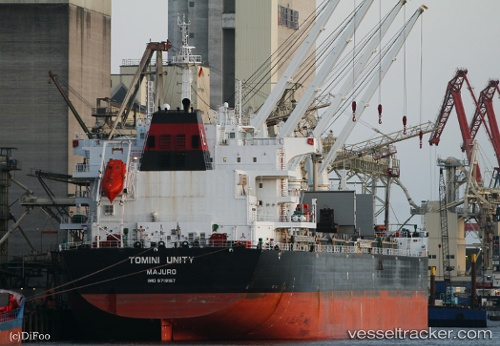
Vessel Tomini Unity IMO: 9718167, MMSI: 538006521 Bulk Carrier
UTC, 23.13605, -134.27682, course: 288, speed: 10
UTC, 23.23592, -134.70697, course: 283, speed: 10.3
2026-02-08 16:09:54 UTC, 23.30109, -135.02847, course: 283, speed: 10.1
Live AIS position:
UTC. 18 nm SW of Sundance),
updated 2026-02-08 16:09:54 UTC.
Find the position of the vessel Tomini Unity on the map. The latter are known coordinates and path.
marine traffic ship tracker show on live map
The current position of vessel Tomini Unity is 23.30109 lat / -135.02847 lng. Updated: 2026-02-08 16:09:54 UTCDetails:
Last coordinates of the vessel:
UTC, 23.05962, -133.92615, course: 287, speed: 9.7UTC, 23.13605, -134.27682, course: 288, speed: 10
UTC, 23.23592, -134.70697, course: 283, speed: 10.3
2026-02-08 16:09:54 UTC, 23.30109, -135.02847, course: 283, speed: 10.1