 vesseltracker.com
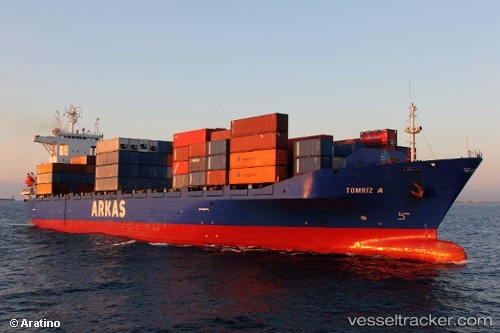
Vessel Tomriz A IMO: 9126754, MMSI: 271001058 Container Ship
UTC, 35.84500, 10.70333, course: -1, speed: 0
UTC, 35.84500, 10.70500, course: -1, speed: 0
2026-02-08 19:28:25 UTC, 35.84333, 10.70500, course: -1, speed: 0
Live AIS position:
UTC. Near Sousse),
updated 2026-02-08 19:28:25 UTC.
Find the position of the vessel Tomriz A on the map. The latter are known coordinates and path.
marine traffic ship tracker show on live map
The current position of vessel Tomriz A is 35.84333 lat / 10.70500 lng. Updated: 2026-02-08 19:28:25 UTCCurrently sailing under the flag of Turkey
Tomriz A built in 1997 year
Deadweight:
19338 tDetails:
Last coordinates of the vessel:
UTC, 35.84500, 10.70333, course: -1, speed: 0UTC, 35.84500, 10.70333, course: -1, speed: 0
UTC, 35.84500, 10.70500, course: -1, speed: 0
2026-02-08 19:28:25 UTC, 35.84333, 10.70500, course: -1, speed: 0