 vesseltracker.com
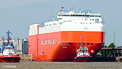
Vessel Tongala IMO: 9605786, MMSI: 215654000 Vehicles Carrier
UTC, -32.4132, 16.3626, course: 151, speed: 13.8
UTC, -32.9211, 16.7471, course: 148, speed: 14.1
2026-02-01 11:55:27 UTC, -33.2733, 17.0225, course: 147, speed: 14.5
Live AIS position:
UTC. 44 nm W of Saldanha Bay),
updated 2026-02-01 11:55:27 UTC.
Find the position of the vessel Tongala on the map. The latter are known coordinates and path.
marine traffic ship tracker show on live map
The current position of vessel Tongala is -33.2733 lat / 17.0225 lng. Updated: 2026-02-01 11:55:27 UTCDetails:
Last coordinates of the vessel:
UTC, -32.114, 16.123, course: 147, speed: 13UTC, -32.4132, 16.3626, course: 151, speed: 13.8
UTC, -32.9211, 16.7471, course: 148, speed: 14.1
2026-02-01 11:55:27 UTC, -33.2733, 17.0225, course: 147, speed: 14.5