 vesseltracker.com
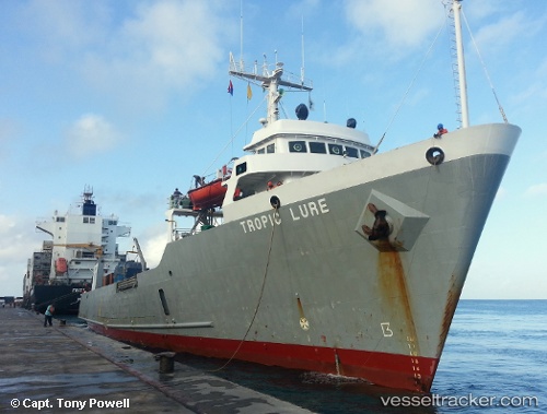
Vessel Tropic Lure IMO: 8204171, MMSI: 377912000 General Cargo Ship
UTC, 24.16333, -81.52333, course: -1, speed: 12
UTC, 24.05833, -81.72167, course: -1, speed: 11
2026-01-31 13:31:07 UTC, 23.88167, -82.08833, course: -1, speed: 11
Live AIS position:
UTC. 43 nm S of Key West),
updated 2026-01-31 13:31:07 UTC.
Find the position of the vessel Tropic Lure on the map. The latter are known coordinates and path.
marine traffic ship tracker show on live map
The current position of vessel Tropic Lure is 23.88167 lat / -82.08833 lng. Updated: 2026-01-31 13:31:07 UTCCurrently sailing under the flag of St Vincent Grenadines
Tropic Lure built in 1983 year
Deadweight:
2563 tDetails:
Last coordinates of the vessel:
UTC, 24.35667, -81.13833, course: -1, speed: 11UTC, 24.16333, -81.52333, course: -1, speed: 12
UTC, 24.05833, -81.72167, course: -1, speed: 11
2026-01-31 13:31:07 UTC, 23.88167, -82.08833, course: -1, speed: 11