 vesseltracker.com
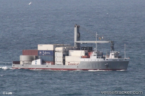
Vessel Tropic Night IMO: 7523673, MMSI: 377906000 Landing Craft
UTC, 18.22415, -64.90115, course: -1, speed: 10.7
UTC, 18.33413, -64.95064, course: -1, speed: 0.1
2026-01-31 14:02:57 UTC, 18.33409, -64.95062, course: -1, speed: 0.1
Live AIS position:
UTC. Near Charlotte Amalie),
updated 2026-01-31 14:02:57 UTC.
Find the position of the vessel Tropic Night on the map. The latter are known coordinates and path.
marine traffic ship tracker show on live map
The current position of vessel Tropic Night is 18.33409 lat / -64.95062 lng. Updated: 2026-01-31 14:02:57 UTCCurrently sailing under the flag of St Vincent Grenadines
Tropic Night built in 1976 year
Deadweight:
2333 tDetails:
Last coordinates of the vessel:
UTC, 18.01983, -64.60470, course: -1, speed: 10.6UTC, 18.22415, -64.90115, course: -1, speed: 10.7
UTC, 18.33413, -64.95064, course: -1, speed: 0.1
2026-01-31 14:02:57 UTC, 18.33409, -64.95062, course: -1, speed: 0.1