 vesseltracker.com
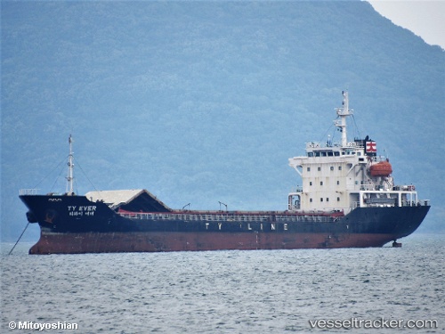
Vessel Ty Ever IMO: 9403920, MMSI: 440904000 General Cargo Ship
UTC, 35.46213, 129.43459, course: 279, speed: 0.3
UTC, 35.46052, 129.43420, course: 321, speed: 0.4
2026-02-06 19:56:54 UTC, 35.46006, 129.43332, course: 353, speed: 0.4
Live AIS position:
UTC. Near Ulsan),
updated 2026-02-06 19:56:54 UTC.
Find the position of the vessel Ty Ever on the map. The latter are known coordinates and path.
marine traffic ship tracker show on live map
The current position of vessel Ty Ever is 35.46006 lat / 129.43332 lng. Updated: 2026-02-06 19:56:54 UTCCurrently sailing under the flag of Korea
Ty Ever built in 2007 year
Deadweight:
6260 tDetails:
Last coordinates of the vessel:
UTC, 35.46222, 129.43401, course: 264, speed: 0.2UTC, 35.46213, 129.43459, course: 279, speed: 0.3
UTC, 35.46052, 129.43420, course: 321, speed: 0.4
2026-02-06 19:56:54 UTC, 35.46006, 129.43332, course: 353, speed: 0.4