 vesseltracker.com
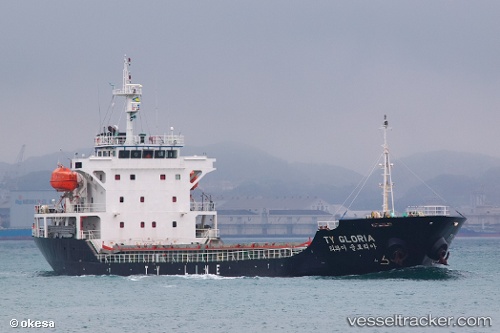
Vessel Ty Gloria IMO: 9472050, MMSI: 441596000 General Cargo Ship
UTC, 35.58111, 140.03259, course: 333, speed: 0
UTC, 35.58114, 140.03278, course: 324, speed: 0
2026-02-06 18:24:37 UTC, 35.58114, 140.03270, course: 332, speed: 0
Live AIS position:
UTC. Near CHIBA),
updated 2026-02-06 18:24:37 UTC.
Find the position of the vessel Ty Gloria on the map. The latter are known coordinates and path.
marine traffic ship tracker show on live map
The current position of vessel Ty Gloria is 35.58114 lat / 140.03270 lng. Updated: 2026-02-06 18:24:37 UTCCurrently sailing under the flag of Korea
Ty Gloria built in 2009 year
Deadweight:
6225 tDetails:
Last coordinates of the vessel:
UTC, 35.58107, 140.03230, course: 342, speed: 0UTC, 35.58111, 140.03259, course: 333, speed: 0
UTC, 35.58114, 140.03278, course: 324, speed: 0
2026-02-06 18:24:37 UTC, 35.58114, 140.03270, course: 332, speed: 0