 vesseltracker.com
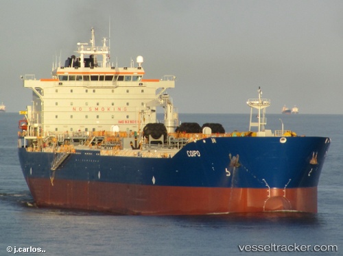
Vessel UCAYALI IMO: 9290610, MMSI: 760001880 Chemical/Oil Products Tanker
UTC, -4.55997, -81.30022, course: 115, speed: 0.1
UTC, -4.55833, -81.29667, course: -1, speed: 0
2026-02-11 18:23:14 UTC, -4.55833, -81.29667, course: -1, speed: 0
Live AIS position:
UTC. Near Talara),
updated 2026-02-11 18:23:14 UTC.
Find the position of the vessel UCAYALI on the map. The latter are known coordinates and path.
marine traffic ship tracker show on live map
The current position of vessel UCAYALI is -4.55833 lat / -81.29667 lng. Updated: 2026-02-11 18:23:14 UTCCurrently sailing under the flag of Peru
UCAYALI built in 2005 year
Deadweight:
47300 tDetails:
Last coordinates of the vessel:
UTC, -4.55833, -81.29833, course: -1, speed: 0UTC, -4.55997, -81.30022, course: 115, speed: 0.1
UTC, -4.55833, -81.29667, course: -1, speed: 0
2026-02-11 18:23:14 UTC, -4.55833, -81.29667, course: -1, speed: 0