 vesseltracker.com
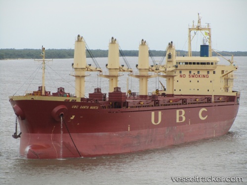
Vessel Ubc Santa Marta IMO: 9380805, MMSI: 210234000 Bulk Carrier
UTC, 29.92548, -59.87540, course: 180, speed: 11.5
UTC, 29.54820, -59.87811, course: 179, speed: 11.5
2026-02-11 22:12:11 UTC, 29.13851, -59.87127, course: 183, speed: 11.9
Live AIS position:
UTC. 257 nm NW of Villa Elisa),
updated 2026-02-11 22:12:11 UTC.
Find the position of the vessel Ubc Santa Marta on the map. The latter are known coordinates and path.
marine traffic ship tracker show on live map
The current position of vessel Ubc Santa Marta is 29.13851 lat / -59.87127 lng. Updated: 2026-02-11 22:12:11 UTCCurrently sailing under the flag of Cyprus
Details:
Last coordinates of the vessel:
UTC, 30.43014, -59.92945, course: 172, speed: 11.9UTC, 29.92548, -59.87540, course: 180, speed: 11.5
UTC, 29.54820, -59.87811, course: 179, speed: 11.5
2026-02-11 22:12:11 UTC, 29.13851, -59.87127, course: 183, speed: 11.9