 vesseltracker.com
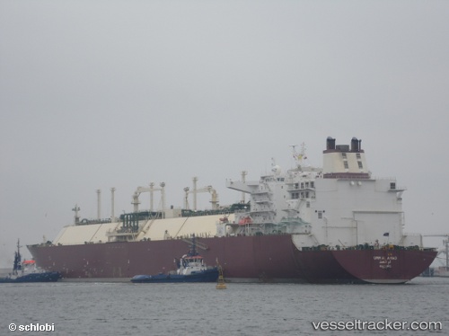
Vessel Umm Al Amad IMO: 9360829, MMSI: 538003073 Lng Tanker
UTC, 25.87366, 51.78898, course: 88, speed: 0
UTC, 25.87244, 51.78946, course: 55, speed: 0
2026-02-12 17:20:54 UTC, 25.87243, 51.78959, course: 51, speed: 0
Live AIS position:
UTC. Near RAS LAFFAN),
updated 2026-02-12 17:20:54 UTC.
Find the position of the vessel Umm Al Amad on the map. The latter are known coordinates and path.
marine traffic ship tracker show on live map
The current position of vessel Umm Al Amad is 25.87243 lat / 51.78959 lng. Updated: 2026-02-12 17:20:54 UTCCurrently sailing under the flag of Marshall Is
Umm Al Amad built in 2008 year
Deadweight:
121730 tDetails:
Last coordinates of the vessel:
UTC, 25.87415, 51.78901, course: 103, speed: 0UTC, 25.87366, 51.78898, course: 88, speed: 0
UTC, 25.87244, 51.78946, course: 55, speed: 0
2026-02-12 17:20:54 UTC, 25.87243, 51.78959, course: 51, speed: 0