 vesseltracker.com
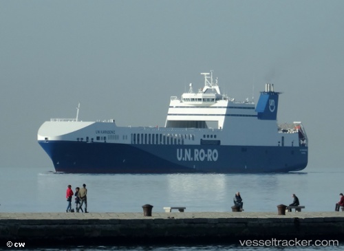
Vessel Un Karadeniz IMO: 9356749, MMSI: 271002571 Ro Ro Cargo Ship
UTC, 41.93642, 9.93034, course: 170, speed: 11.2
UTC, 41.83066, 9.86937, course: 2, speed: 10.5
2026-02-13 01:35:14 UTC, 42.09155, 9.87519, course: 358, speed: 10.3
Live AIS position:
UTC. 16 nm E of Aléria),
updated 2026-02-13 01:35:14 UTC.
Find the position of the vessel Un Karadeniz on the map. The latter are known coordinates and path.
marine traffic ship tracker show on live map
The current position of vessel Un Karadeniz is 42.09155 lat / 9.87519 lng. Updated: 2026-02-13 01:35:14 UTCCurrently sailing under the flag of Turkey
Un Karadeniz built in 2008 year
Deadweight:
11636 tDetails:
Last coordinates of the vessel:
UTC, 42.26942, 9.86725, course: 178, speed: 10.3UTC, 41.93642, 9.93034, course: 170, speed: 11.2
UTC, 41.83066, 9.86937, course: 2, speed: 10.5
2026-02-13 01:35:14 UTC, 42.09155, 9.87519, course: 358, speed: 10.3