 vesseltracker.com
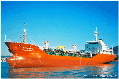
Vessel Unam Frontier IMO: 9118642, MMSI: 440102110 Chemical Oil Products Tanker
UTC, 34.90543, 127.66896, course: 326, speed: 0.1
UTC, 34.90547, 127.66896, course: 320, speed: 0.1
2026-02-12 17:24:10 UTC, 34.90544, 127.66896, course: 323, speed: 0.1
Live AIS position:
UTC. Near Gwangyang),
updated 2026-02-12 17:24:10 UTC.
Find the position of the vessel Unam Frontier on the map. The latter are known coordinates and path.
marine traffic ship tracker show on live map
The current position of vessel Unam Frontier is 34.90544 lat / 127.66896 lng. Updated: 2026-02-12 17:24:10 UTCDetails:
Last coordinates of the vessel:
UTC, 34.90541, 127.66894, course: 321, speed: 0.1UTC, 34.90543, 127.66896, course: 326, speed: 0.1
UTC, 34.90547, 127.66896, course: 320, speed: 0.1
2026-02-12 17:24:10 UTC, 34.90544, 127.66896, course: 323, speed: 0.1