 vesseltracker.com
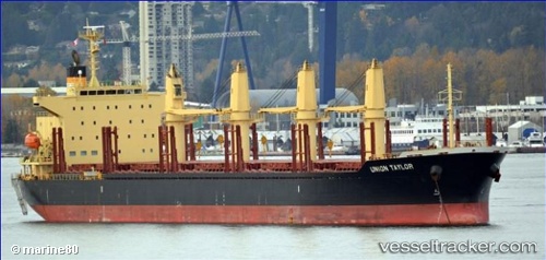
Vessel Union Taylor IMO: 9691644, MMSI: 538005754 Bulk Carrier
UTC, -15.95450, -13.48226, course: 312, speed: 11.3
UTC, -15.63345, -13.90480, course: 311, speed: 11.5
2026-02-14 07:19:40 UTC, -15.49371, -14.08966, course: 308, speed: 12.4
Live AIS position:
UTC. Open sea (no nearby ports in database)),
updated 2026-02-14 07:19:40 UTC.
Find the position of the vessel Union Taylor on the map. The latter are known coordinates and path.
marine traffic ship tracker show on live map
The current position of vessel Union Taylor is -15.49371 lat / -14.08966 lng. Updated: 2026-02-14 07:19:40 UTCCurrently sailing under the flag of Marshall Is
Details:
Last coordinates of the vessel:
UTC, -16.16541, -13.20136, course: 308, speed: 11.8UTC, -15.95450, -13.48226, course: 312, speed: 11.3
UTC, -15.63345, -13.90480, course: 311, speed: 11.5
2026-02-14 07:19:40 UTC, -15.49371, -14.08966, course: 308, speed: 12.4