 vesseltracker.com
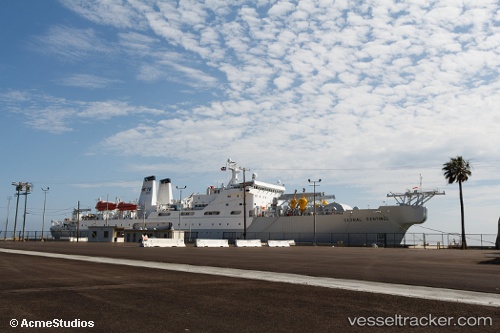
Vessel Us Government Vessel IMO: 8900866, MMSI: 369134000 Cable Layer
UTC, 27.54800, -83.12225, course: 210, speed: 13
UTC, 27.54800, -83.12225, course: 210, speed: 13
2026-02-09 00:07:43 UTC, 27.54800, -83.12225, course: 210, speed: 13
Live AIS position:
UTC. 21 nm W of Anna Maria),
updated 2026-02-09 00:07:43 UTC.
Find the position of the vessel Us Government Vessel on the map. The latter are known coordinates and path.
marine traffic ship tracker show on live map
The current position of vessel Us Government Vessel is 27.54800 lat / -83.12225 lng. Updated: 2026-02-09 00:07:43 UTCCurrently sailing under the flag of USA
Us Government Vessel built in 1991 year
Deadweight:
8527 tDetails:
Last coordinates of the vessel:
UTC, 27.59131, -83.06798, course: 264, speed: 12.5UTC, 27.54800, -83.12225, course: 210, speed: 13
UTC, 27.54800, -83.12225, course: 210, speed: 13
2026-02-09 00:07:43 UTC, 27.54800, -83.12225, course: 210, speed: 13