
.
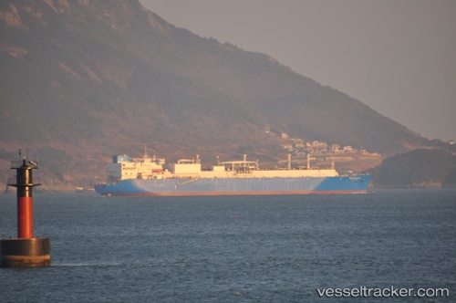
Vessel photo of VALERA (IMO 9630004) vesseltracker.com

OM flag VALERA

Vessel type: Lng Tanker | IMO: 9630004 | MMSI: MMSI: 461000243
Call sign:
Current Status

Where is the vessel?

VALERA is currently in 396 nm W of Baía dos Tigres, based on AIS data received about 1h ago.

Latest AIS update:

Current position: 18.92574° S, 5.25791° E (396 nm W of Baía dos Tigres)

Average speed (last 7 days): Loading…

Average speed (last 30 days): Loading…

Vessel profile: VALERA is a Lng Tanker with dimensions m x m.

This page combines live AIS, route history, probable destination signals, nearby traffic, and port activity for practical vessel monitoring.

The current position of vessel VALERA is -18.92574 lat / 5.25791 lng. Updated: 2026-05-09 16:04:51 UTC
Nearest reference points:
  • Open sea, approx. 401 nm off the nearest listed port
  • Open sea, approx. 400 nm off the nearest listed port
  • Open sea, approx. 402 nm off the nearest listed port

Currently sailing under the flag of Oman OM flag

Details:

Live Vessel VALERA Analytics (details, animations, etc.)


Recent AIS points (UTC):
2026-05-09 13:12:50 UTC · -19.56182, 5.68663 · SOG 15.8 kn · COG 322°
2026-05-09 13:54:03 UTC · -19.42301, 5.56392 · SOG 15.7 kn · COG 327°
2026-05-09 15:58:43 UTC · -18.94911, 5.27208 · SOG 15.9 kn · COG 330°
2026-05-09 16:04:51 UTC · -18.92574, 5.25791 · SOG 15.9 kn · COG 330°

Track of the vessel in the last 60 days


UTC: --
Start: -- Track timeline (UTC) End: --
Encountered: --


Link to the map:


Find another ship

VALERA (461000243) last ports (portcalls and passsages)