 vesseltracker.com
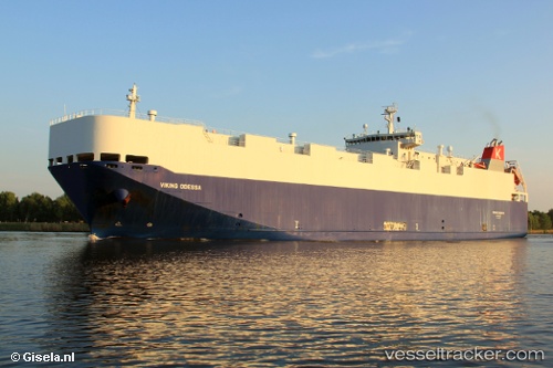
Find the position of the vessel VIKING ODESSA on the map. The latter are known coordinates and path.
marine traffic ship tracker show on live map
The current position of vessel VIKING ODESSA is 23.017 lat / -90.5764 lng. Updated: 2024-04-26 01:36:35 UTCCurrently sailing under the flag of Marshall Islands
VIKING ODESSA built in 2009 year
Port of registry:
Singapore (sovereign island country and city-state in maritime Southeast Asia)Deadweight:
5432 tGross tonnage:
20216Service entry:
2009-01-01T00:00:00ZDetails:
Last coordinates of the vessel:
UTC, 23.0617, -90.045, course: -1, speed: 12UTC, 23.0483, -90.2017, course: -1, speed: 12
UTC, 23.0317, -90.4033, course: -1, speed: 12
2024-04-26 01:36:35 UTC, 23.017, -90.5764, course: 265, speed: 12.3