 vesseltracker.com
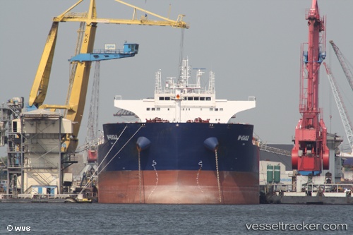
Vessel W eagle IMO: 9484675, MMSI: 636014570 Bulk Carrier
UTC, 36.91260, 126.23547, course: 60, speed: 0
UTC, 36.91262, 126.23531, course: 60, speed: 0
2026-02-14 18:08:45 UTC, 36.91167, 126.23500, course: -1, speed: 0
Live AIS position:
UTC. Near TAEAN-GUN),
updated 2026-02-14 18:08:45 UTC.
Find the position of the vessel W eagle on the map. The latter are known coordinates and path.
marine traffic ship tracker show on live map
The current position of vessel W eagle is 36.91167 lat / 126.23500 lng. Updated: 2026-02-14 18:08:45 UTCCurrently sailing under the flag of Liberia
W eagle built in 2011 year
Deadweight:
92803 tDetails:
Last coordinates of the vessel:
UTC, 36.91262, 126.23542, course: 60, speed: 0UTC, 36.91260, 126.23547, course: 60, speed: 0
UTC, 36.91262, 126.23531, course: 60, speed: 0
2026-02-14 18:08:45 UTC, 36.91167, 126.23500, course: -1, speed: 0