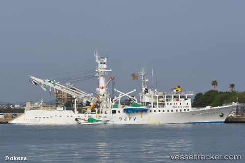
vessel Wakabamaru No.7 IMO: 9524865, Fishing Vessel
Vessel Wakabamaru No.7 IMO: 9524865, Fishing Vessel
MMSI: 432726000 callsign: 7JFV size: 14x70

Find the position of the vessel Wakabamaru No.7 on the map. The latter are known coordinates and path.

marine traffic ship tracker show on live map

The current position of vessel Wakabamaru No.7 is 31.2039 lat / 130.646 lng. Updated: 2024-04-25 13:37:52 UTC
Payload_mass:
1507 tonne
Gross tonnage:
760
Service entry:
2009-01-01T00:00:00Z

Manufacturer:
Miho Zosen (shipyard in Japan)
Details:


Last coordinates of the vessel:
UTC, 31.2039, 130.646, course: 336, speed: 0
2024-04-25 13:37:52 UTC, 31.2039, 130.646, course: 336, speed: 0

Track of the vessel in the last 14 days


Most frequent ports a vessels calls at Wakabamaru No.7 (432726000):

Shiogama, traffic: 7
Tarawa Atoll, traffic: 2
Rabaul, traffic: 1

Link to the map:


Find another ship

Wakabamaru_No.7 (432726000) last ports (portcalls and passsages)

Shiogama | 2023-10-20 03:59:01
Shiogama | 2023-10-16 03:17:20
Shiogama | 2023-10-05 02:22:41
Shiogama | 2023-09-22 01:42:16
Shiogama | 2023-09-18 01:23:07
Shiogama | 2023-09-12 04:55:49
Rabaul | 2023-04-29 21:18:19
Shiogama | 2022-02-10 03:35:02
Tarawa Atoll | 2022-01-23 19:48:20