 vesseltracker.com
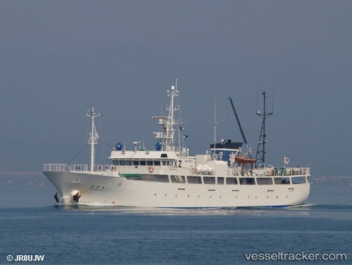
Vessel Wakatake Maru IMO: 9799472, MMSI: 431454000 Fishing Vessel
UTC, 20.93104, -173.21060, course: 272, speed: 12.3
UTC, 20.97821, -173.66286, course: 277, speed: 12.5
2026-02-17 07:26:52 UTC, 21.00064, -173.87898, course: 277, speed: 11.3
Live AIS position:
UTC. 357 nm NW of Johnston Island),
updated 2026-02-17 07:26:52 UTC.
Find the position of the vessel Wakatake Maru on the map. The latter are known coordinates and path.
marine traffic ship tracker show on live map
The current position of vessel Wakatake Maru is 21.00064 lat / -173.87898 lng. Updated: 2026-02-17 07:26:52 UTCDetails:
Last coordinates of the vessel:
UTC, 20.88883, -172.80441, course: 277, speed: 12.4UTC, 20.93104, -173.21060, course: 272, speed: 12.3
UTC, 20.97821, -173.66286, course: 277, speed: 12.5
2026-02-17 07:26:52 UTC, 21.00064, -173.87898, course: 277, speed: 11.3