 vesseltracker.com
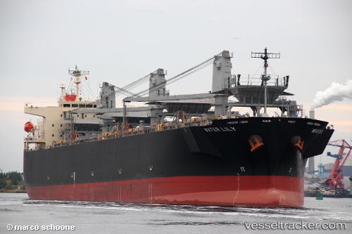
Vessel Water Lily IMO: 9608221, MMSI: 351251000 Wood Chips Carrier
UTC, 14.99944, -21.26486, course: 20, speed: 9.5
UTC, 15.38506, -21.10506, course: 22, speed: 10
2026-02-22 15:59:19 UTC, 15.67682, -20.98450, course: 29, speed: 9.2
Live AIS position:
UTC. 129 nm SE of Ilha do Sal),
updated 2026-02-22 15:59:19 UTC.
Find the position of the vessel Water Lily on the map. The latter are known coordinates and path.
marine traffic ship tracker show on live map
The current position of vessel Water Lily is 15.67682 lat / -20.98450 lng. Updated: 2026-02-22 15:59:19 UTCCurrently sailing under the flag of Panama
Details:
Last coordinates of the vessel:
UTC, 14.85850, -21.32190, course: 22, speed: 9.8UTC, 14.99944, -21.26486, course: 20, speed: 9.5
UTC, 15.38506, -21.10506, course: 22, speed: 10
2026-02-22 15:59:19 UTC, 15.67682, -20.98450, course: 29, speed: 9.2