 vesseltracker.com
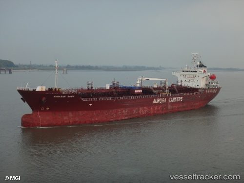
Vessel Wawasan Ruby IMO: 9477517, MMSI: 355619000 Chemical Oil Products Tanker
UTC, 0.29751, 87.01107, course: 230, speed: 11.4
UTC, 0.00101, 86.63483, course: 230, speed: 11.1
2026-02-22 01:55:40 UTC, -0.23658, 86.32912, course: 230, speed: 11.2
Live AIS position:
UTC. 395 nm S of Abakaliki),
updated 2026-02-22 01:55:40 UTC.
Find the position of the vessel Wawasan Ruby on the map. The latter are known coordinates and path.
marine traffic ship tracker show on live map
The current position of vessel Wawasan Ruby is -0.23658 lat / 86.32912 lng. Updated: 2026-02-22 01:55:40 UTCCurrently sailing under the flag of Panama
Wawasan Ruby built in 2010 year
Deadweight:
19957 tDetails:
Last coordinates of the vessel:
UTC, 0.47450, 87.23438, course: 230, speed: 11.2UTC, 0.29751, 87.01107, course: 230, speed: 11.4
UTC, 0.00101, 86.63483, course: 230, speed: 11.1
2026-02-22 01:55:40 UTC, -0.23658, 86.32912, course: 230, speed: 11.2