 vesseltracker.com
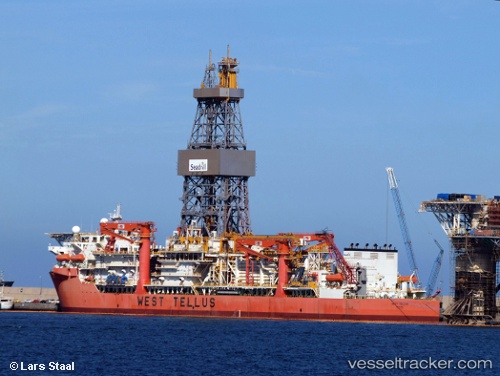
Vessel West Tellus IMO: 9623934, MMSI: 373289000 Drilling Ship
UTC, -24.67517, -42.43500, course: 39, speed: 0.1
UTC, -24.67517, -42.43500, course: 39, speed: 0.2
2026-02-20 16:10:34 UTC, -24.67517, -42.43500, course: 39, speed: 0.2
Live AIS position:
UTC. 56 nm NE of Cidade de Angra dos Reis FPSO),
updated 2026-02-20 16:10:34 UTC.
Find the position of the vessel West Tellus on the map. The latter are known coordinates and path.
marine traffic ship tracker show on live map
The current position of vessel West Tellus is -24.67517 lat / -42.43500 lng. Updated: 2026-02-20 16:10:34 UTCDetails:
Last coordinates of the vessel:
UTC, -24.67517, -42.43500, course: 39, speed: 0UTC, -24.67517, -42.43500, course: 39, speed: 0.1
UTC, -24.67517, -42.43500, course: 39, speed: 0.2
2026-02-20 16:10:34 UTC, -24.67517, -42.43500, course: 39, speed: 0.2