 vesseltracker.com
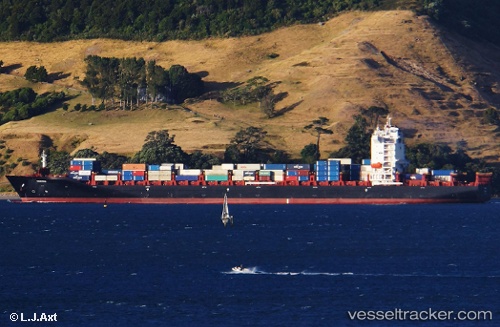
Vessel Wiking IMO: 9708382, MMSI: 218549000 Container Ship
UTC, 22.2944, 68.5563, course: 267, speed: 0
UTC, 22.2952, 68.5568, course: 293, speed: 0.5
2026-02-19 07:55:33 UTC, 22.3016, 68.5711, course: 93, speed: 10.5
Live AIS position:
UTC. 30 nm W of Okha),
updated 2026-02-19 07:55:33 UTC.
Find the position of the vessel Wiking on the map. The latter are known coordinates and path.
marine traffic ship tracker show on live map
The current position of vessel Wiking is 22.3016 lat / 68.5711 lng. Updated: 2026-02-19 07:55:33 UTCDetails:
Last coordinates of the vessel:
UTC, 22.2919, 68.5543, course: 10, speed: 0UTC, 22.2944, 68.5563, course: 267, speed: 0
UTC, 22.2952, 68.5568, course: 293, speed: 0.5
2026-02-19 07:55:33 UTC, 22.3016, 68.5711, course: 93, speed: 10.5