 vesseltracker.com
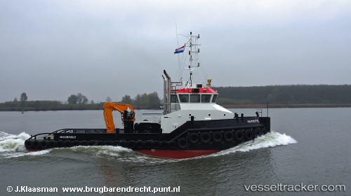
Vessel Wil S IMO: 9688867, MMSI: 244630433 Tug
UTC, 38.00980, 12.51293, course: 97, speed: 0
UTC, 38.00979, 12.51294, course: 96, speed: 0
2026-02-18 23:48:51 UTC, 38.00981, 12.51289, course: 97, speed: 0
Live AIS position:
UTC. Near Trapani),
updated 2026-02-18 23:48:51 UTC.
Find the position of the vessel Wil S on the map. The latter are known coordinates and path.
marine traffic ship tracker show on live map
The current position of vessel Wil S is 38.00981 lat / 12.51289 lng. Updated: 2026-02-18 23:48:51 UTCCurrently sailing under the flag of Netherlands
Details:
Last coordinates of the vessel:
UTC, 38.00983, 12.51292, course: 97, speed: 0UTC, 38.00980, 12.51293, course: 97, speed: 0
UTC, 38.00979, 12.51294, course: 96, speed: 0
2026-02-18 23:48:51 UTC, 38.00981, 12.51289, course: 97, speed: 0