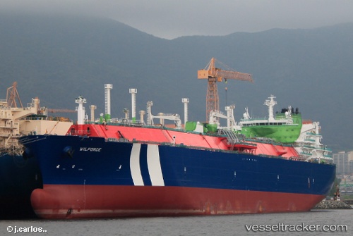
vessel Wilforce IMO: 9627954, Lng Tanker
vesseltracker.com
Vessel Wilforce IMO: 9627954, Lng Tanker
MMSI: 258702000 callsign: LARL7 size: 44x290

Find the position of the vessel Wilforce on the map. The latter are known coordinates and path.

marine traffic ship tracker show on live map

The current position of vessel Wilforce is 36.4961 lat / -6.58611 lng. Updated: 2023-01-26 12:10:25 UTC
Details:


Last coordinates of the vessel:
2023-01-26 12:10:25 UTC, 36.4961, -6.58611, course: 289, speed: 0.3

Track of the vessel in the last 14 days


Most frequent ports a vessels calls at Wilforce (258702000):

Sambu, traffic: 17
Singapore, traffic: 10
Oita, traffic: 3
Penang, traffic: 2
Strait Of Gibraltar, traffic: 2
Dagu Bar, traffic: 2
Gladstone Harbor, traffic: 2
Port Said, traffic: 1
Puerto De La Luz, traffic: 1
Algeciras, traffic: 1
Bur Ibrahim, traffic: 1
Yokkaichi, traffic: 1
Huelva, traffic: 1
Las Palmas, traffic: 1

Link to the map:


Find another ship

Wilforce (258702000) last ports (portcalls and passsages)

Port Said | 2023-01-04 17:57:51
Bur Ibrahim | 2023-01-04 08:44:48
Singapore | 2022-12-22 08:27:35
Yokkaichi | 2022-12-15 02:28:59
Huelva | 2022-09-07 13:57:56
Strait Of Gibraltar | 2022-08-25 22:24:38
Algeciras | 2022-08-01 16:53:07
Strait Of Gibraltar | 2022-08-01 02:04:51
Las Palmas | 2022-07-13 07:27:06
Sambu | 2022-05-19 22:40:09
Oita | 2022-05-08 01:31:47
Sambu | 2022-04-20 00:51:36
Sambu | 2022-04-20 00:36:35
Gladstone Harbor | 2022-03-29 03:10:22
Oita | 2022-03-10 03:15:42
Singapore | 2022-02-28 21:50:51
Penang | 2022-02-17 06:29:45
Singapore | 2022-01-23 16:40:19
Sambu | 2022-01-23 16:05:50
Sambu | 2022-01-23 15:55:29
Sambu | 2022-01-23 15:50:00
Singapore | 2021-12-14 16:39:51
Dagu Bar | 2021-12-03 02:16:59