 vesseltracker.com
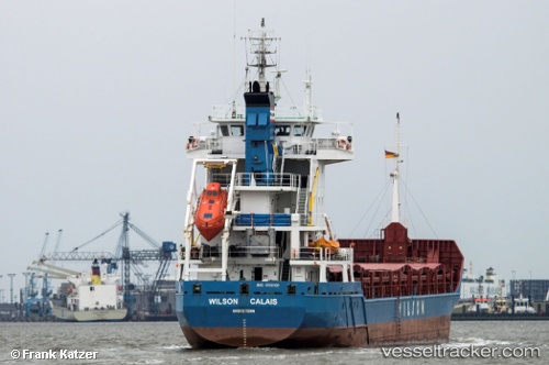
Vessel Wilson Calais IMO: 9156101, MMSI: 314255000 Multi Purpose Carrier
UTC, 43.82850, -9.72533, course: 210, speed: 5.7
UTC, 43.72267, -9.79917, course: 210, speed: 5.7
2026-02-17 23:01:43 UTC, 43.61083, -9.88317, course: 216, speed: 5.1
Live AIS position:
UTC. 28 nm W of Villanueva de Lorenzana),
updated 2026-02-17 23:01:43 UTC.
Find the position of the vessel Wilson Calais on the map. The latter are known coordinates and path.
marine traffic ship tracker show on live map
The current position of vessel Wilson Calais is 43.61083 lat / -9.88317 lng. Updated: 2026-02-17 23:01:43 UTCCurrently sailing under the flag of Barbados
Wilson Calais built in 2001 year
Deadweight:
4450 tDetails:
Last coordinates of the vessel:
UTC, 44.05900, -9.57233, course: 209, speed: 5.8UTC, 43.82850, -9.72533, course: 210, speed: 5.7
UTC, 43.72267, -9.79917, course: 210, speed: 5.7
2026-02-17 23:01:43 UTC, 43.61083, -9.88317, course: 216, speed: 5.1