 vesseltracker.com
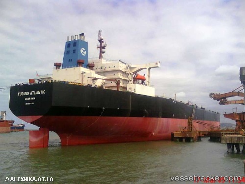
Vessel Wugang Atlantic IMO: 9085352, MMSI: 636013827 Ore Oil Carrier
UTC, -74.29336, 114.45709, course: -1, speed: 51.2
UTC, -74.29336, 114.45709, course: -1, speed: 51.2
2026-02-07 03:16:48 UTC, -74.29336, 114.45709, course: -1, speed: 51.2
Live AIS position:
UTC. 149 nm W of Concordia),
updated 2026-02-07 03:16:48 UTC.
Find the position of the vessel Wugang Atlantic on the map. The latter are known coordinates and path.
marine traffic ship tracker show on live map
The current position of vessel Wugang Atlantic is -74.29336 lat / 114.45709 lng. Updated: 2026-02-07 03:16:48 UTCDetails:
Last coordinates of the vessel:
UTC, -75.64590, 115.64461, course: 185, speed: 25.6UTC, -74.29336, 114.45709, course: -1, speed: 51.2
UTC, -74.29336, 114.45709, course: -1, speed: 51.2
2026-02-07 03:16:48 UTC, -74.29336, 114.45709, course: -1, speed: 51.2