 vesseltracker.com
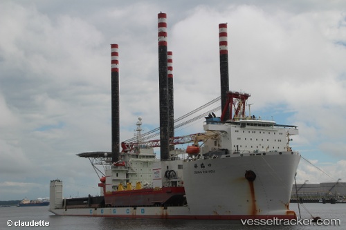
Vessel Xiang Rui Kou IMO: 9483102, MMSI: 414017000 Heavy Load Carrier
UTC, 39.70998, -9.82789, course: 4, speed: 11.1
UTC, 39.94504, -9.82100, course: 4, speed: 11.1
2026-02-21 22:34:26 UTC, 40.48483, -9.82473, course: 3, speed: 11.5
Live AIS position:
UTC. 45 nm W of Canas de Santa Maria),
updated 2026-02-21 22:34:26 UTC.
Find the position of the vessel Xiang Rui Kou on the map. The latter are known coordinates and path.
marine traffic ship tracker show on live map
The current position of vessel Xiang Rui Kou is 40.48483 lat / -9.82473 lng. Updated: 2026-02-21 22:34:26 UTCCurrently sailing under the flag of China
Xiang Rui Kou built in 2011 year
Deadweight:
48293 tDetails:
Last coordinates of the vessel:
UTC, 39.26896, -9.83667, course: 2, speed: 11.9UTC, 39.70998, -9.82789, course: 4, speed: 11.1
UTC, 39.94504, -9.82100, course: 4, speed: 11.1
2026-02-21 22:34:26 UTC, 40.48483, -9.82473, course: 3, speed: 11.5