 vesseltracker.com
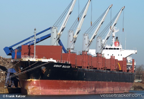
Vessel YALOUSSA IMO: 9464546, MMSI: 538010147 Bulk Carrier
UTC, 33.73457, -7.68485, course: 300, speed: 0.7
UTC, 33.73414, -7.68520, course: 292, speed: 1
2026-02-13 20:02:28 UTC, 33.73387, -7.68529, course: 299, speed: 0.2
Live AIS position:
UTC. Near Casablanca),
updated 2026-02-13 20:02:28 UTC.
Find the position of the vessel YALOUSSA on the map. The latter are known coordinates and path.
marine traffic ship tracker show on live map
The current position of vessel YALOUSSA is 33.73387 lat / -7.68529 lng. Updated: 2026-02-13 20:02:28 UTCCurrently sailing under the flag of Marshall Islands
YALOUSSA built in 2008 year
Deadweight:
28361 tDetails:
Last coordinates of the vessel:
UTC, 33.73480, -7.68504, course: 301, speed: 0.6UTC, 33.73457, -7.68485, course: 300, speed: 0.7
UTC, 33.73414, -7.68520, course: 292, speed: 1
2026-02-13 20:02:28 UTC, 33.73387, -7.68529, course: 299, speed: 0.2