 vesseltracker.com
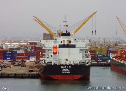
Vessel Yangze 7 IMO: 9718911, MMSI: 636016708 Bulk Carrier
UTC, 28.52576, 33.11046, course: 328, speed: 12.8
UTC, 28.94139, 32.89044, course: 336, speed: 12.6
2026-02-13 15:33:45 UTC, 29.26202, 32.74120, course: 336, speed: 12.5
Live AIS position:
UTC. 19 nm S of Ras as Sidr),
updated 2026-02-13 15:33:45 UTC.
Find the position of the vessel Yangze 7 on the map. The latter are known coordinates and path.
marine traffic ship tracker show on live map
The current position of vessel Yangze 7 is 29.26202 lat / 32.74120 lng. Updated: 2026-02-13 15:33:45 UTCCurrently sailing under the flag of Liberia
Details:
Last coordinates of the vessel:
UTC, 28.19814, 33.33325, course: 312, speed: 12.9UTC, 28.52576, 33.11046, course: 328, speed: 12.8
UTC, 28.94139, 32.89044, course: 336, speed: 12.6
2026-02-13 15:33:45 UTC, 29.26202, 32.74120, course: 336, speed: 12.5